


DWMP23 regional plans and portals
Partnership working
Partnership-working across our region was at the heart of DWMP23. Hear about the value that’s added through our partnership working from Professor Robert Van de Noort, Chair of the Thames Regional Flood and Coastal Committee.
Catchment Strategic Plans
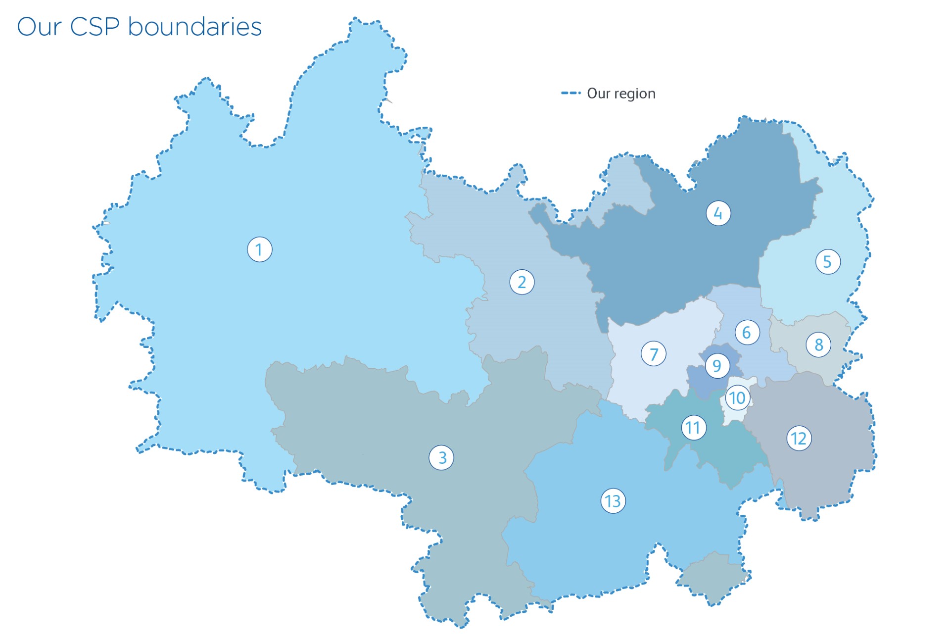
We worked closely with local stakeholders in our region to co-create 13 Catchment Strategic Plans (CSPs).
We developed a CSP for each of our Level 2 planning areas, that we illustrate on our map. They were:
- Oxfordshire, Swindon, Wiltshire, Gloucestershire, Warwickshire, Northamptonshire
- Central Bedfordshire, Buckinghamshire, Slough, Luton
- West Berkshire, Reading, Wokingham, Bracknell Forest, Windsor and Maidenhead, Hampshire, West Sussex
- Hertfordshire
- Essex and Thurrock
- Lee Valley
- North West London
- North East London
- Central North London
- Central South London
- South West London
- South East London
- Surrey
Catchment Strategic Plans
Our CSPs included a long-term shared vision developed with our stakeholders. Within each CSP we detailed the challenges that the area will face in the future and the long-term plans we’ll deliver collaboratively to tackle them.
Customer portal
Our Customer portal has a series of interactive maps that display the different catchment areas and the assessments carried out within them. This portal is for everyone to use, to see what's happening in their catchment area. You'll also find our up-to-date information and progress.
Practitioner portal
Our Practitioner portal includes an interactive map with more technical information and data. This portal is provided for technical specialists who are collaborating with us on this and future DWMPs. You'll also find our up-to-date information and progress.