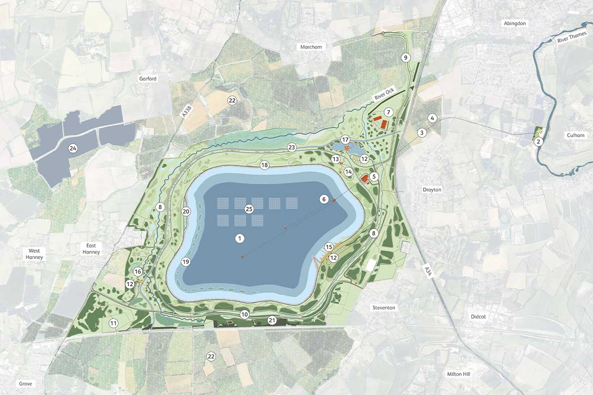
White Horse Reservoir in Oxfordshire
We're proposing a new reservoir in Oxfordshire. The reservoir will help protect public water supplies during periods of drought.
The new reservoir would be filled with water from the River Thames in winter, when there’s plenty of water. We'll release water if river levels drop or demand for water increases.
Reservoirs are valuable because they provide a reliable source of water. They can also offer recreational opportunities, support wildlife habitats, and manage flooding.
We’ve given our South East Strategic Reservoir Option (SESRO) project a new name: White Horse Reservoir. It’s a new name, but the same vision – to ensure secure water supplies for generations to come.
Project update
We’ve completed a statutory consultation on our essential new reservoir for the South East. The consultation ran from 28 October 2025 to 13 January 2026.
We sought feedback on:
- Our indicative master plan
- Our current design proposals
- Our indicative construction activities and schedule
- Managing potential impacts on local communities and the environment
- Our approach to sustainability, project benefits and legacy
The feedback we've received will help us shape our proposals to keep water flowing for the future. For more information, please visit our project website.
Our indicative master plan
An illustration of our proposed new reservoir.

Map key
- Reservoir
- River Thames intake / outfall structures
- River tunnel
- Tunnel shaft
- Pumping station
- Reservoir tunnels and towers
- Southern Water - Water treatment works
- Watercourse diversions
- Main access road
- Stevenson to East Hanney road realignment
- Location of temporary rail sidings for construction
- Car parks
- Visitor centre
- Café on the crest
- Water sports centre
- Nature education centre
- Recreational lakes
- Crest walkway
- Floating islands
- Lagoons
- Woodlands
- Project priority areas for biodiversity
- Water channel
- Replacement solar farm
- Floating solar
Gate 3
Gate 2 reports
You can view our gate 2 reports on our website.
Gate 1 reports
You can view our gate 1 reports on our website.